
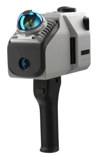
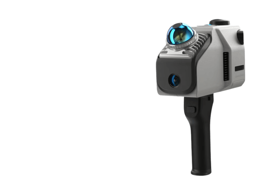
Eagle
The portable scanner with SLAM technology for smart scans
Starting from
€ 3,960.00 + VAT
Also available in convenient monthly installments
The SLAM Scanner for Large-Scale 3D Surveys
If you're wondering what a SLAM scanner is or what a mobile 3D scanner is used for, the 3DMakerPro Eagle is the answer: a cutting-edge technology that enables real-time 3D scanning and mapping without external reference points and with RTK module. It is ideal for topographic, construction, archaeological, and industrial surveys, both indoors and outdoors.
200,000
Points per second
Maintaining data quality even at a speed of 20 km/h
Up to 140 meters
Scanning range
The scanner ensures accurate measurements up to 140 meters away
48 MP
The Camera
Optical system with 48-megapixel fisheye resolution
8K HDR
The Images
8K images with HDR technology, for vibrant colors and a wide dynamic range
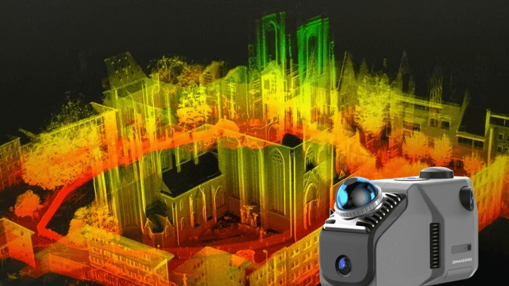
Wide-range and High-Precision Scanning
The 3DMakerPro Eagle is among the best SLAM scanners, capable of modeling entire urban areas, parks, facilities, or historical buildings as you walk.
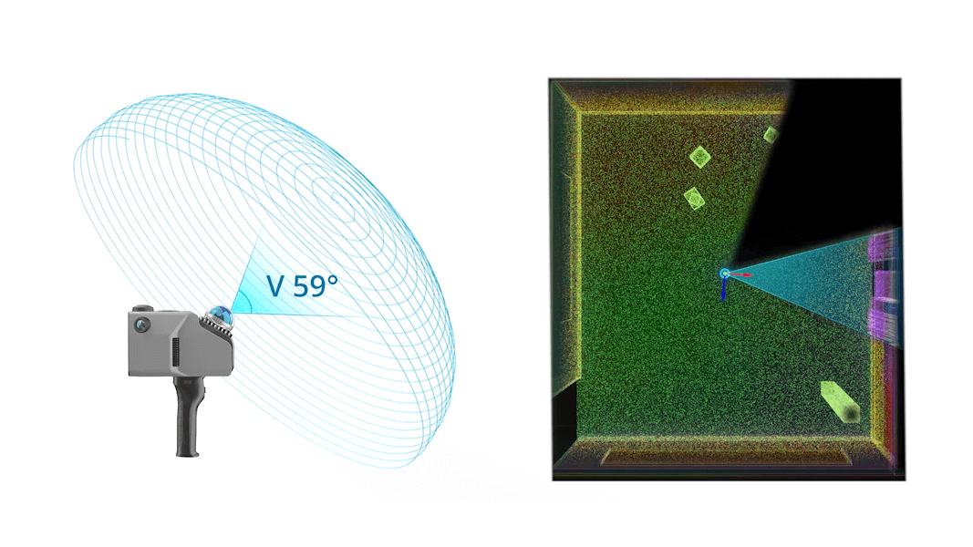
Ultra-Wide Field of View
With a coverage of 360°×59°, it is the ideal tool for those seeking complete 3D surveys even in complex environments.
High-Definition Precision and Images
The 48 MP and 8K HDR images are perfect for photorealistic digital reconstructions, essential for conservation surveys or interior architecture.

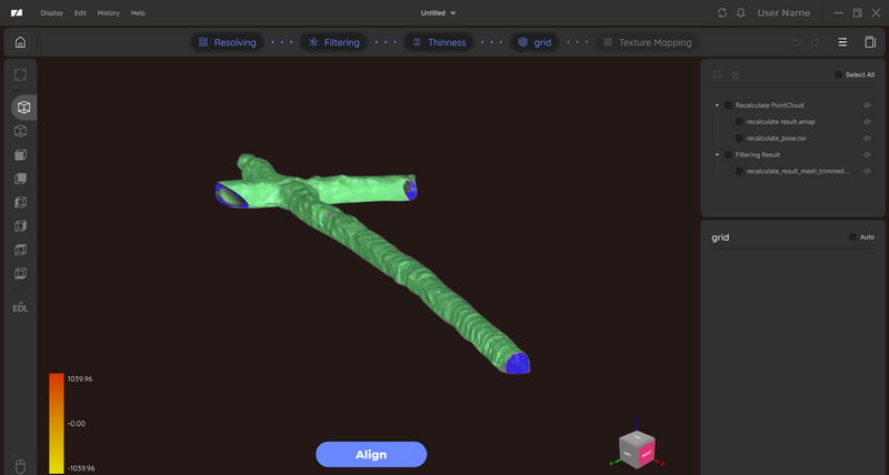
On-Site Instant Review
View the point cloud directly on the 3.5” screen with instant visual feedback: essential to avoid mistakes and duplication.

Real-Time Centimetric Accuracy with RTK Technology
The 3DMakerPro Eagle integrates a RTK (Real Time Kinematic) module enabling centimetric accuracy. Thanks to the connection with a base station and L1/L2 satellite signals, it delivers accurate point clouds even while moving.

Enables Mobile Surveying
Eagle captures up to 200,000 points per second, making it one of the few 3D scanners capable of working even while moving (up to 20 km/h): perfect for dynamic surveys.

Many ask which software is needed to process SLAM data? The Eagle system includes everything, from point cloud cleaning to 3D modeling exportable in major formats.
Advanced Data Processing
The dedicated software allows editing and refining of point cloud data, with output in PLY, PNG+OBJ, and Gaussian-Splatting PLY formats.
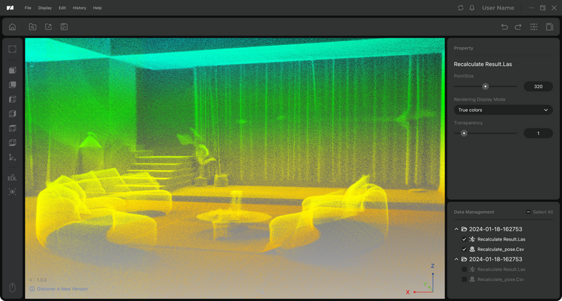
Clean Point Clouds with One Click
Fast and automatic point cloud cleaning to eliminate noise and streamline the entire workflow, improving speed and operational efficiency.
Integrated 3D Modeling Software
Eagle comes with a standalone software for point cloud modeling, providing complete support for survey operations.

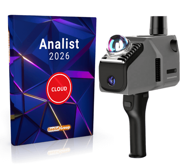
3DMakerpro Eagle–Analist 2026: Maximum Power for Your Projects
If you're looking for a complete solution for professional 3D surveys, the combination of the 3DMakerpro Eagle SLAM and Analist 2026—software powered with Autodesk Technology—is the ideal choice for those working in surveying, construction, engineering, and land registry.
Complete Point Cloud Management
Analist 2026 CLOUD imports the Point Clouds generated by Eagle to:
- Align and orient the surveys
- Create elevations and sections using dynamic blocks for structures
3D Model Creation
Eagle is ideal for large-scale surveys. With Analist 2026, you can import the instrument's Data Files to:
- Generate 3D terrain models
- Create contour lines, longitudinal and cross profiles
- Calculate excavation or fill volumes
SLAM 3DMakerpro Eagle - Standard
All for only
€ 3,960 + VAT
With installment payment option
SLAM Eagle Standard
The compact and versatile solution for precise and instant surveys.


- 1 camera with 48 MP for sharp and detailed images
- Full field of view: 360° × 59°
- Excellent color rendering, ideal for indoor environments and architecture
The Solution includes:
LiDAR Scanner Eagle
x1
x1
Handle
x1
x1
PD Power Adapter
x1
x1
1.5M Dual-End Type-C Cable
x1
x1
USB Pendrive
x1
x1
USB-C to USB-A Adapter
x1
x1
Analist CLOUD 2026
1-year subscription
1-year subscription
Support and Assistance included
SLAM 3DMakerpro Eagle - Max
All for only
€ 4,820 + VAT
With installment payment option
SLAM Eagle Max
Maximum performance and visual quality for the most advanced projects.
- 4 cameras with 48 MP for ultra-realistic textures
- 8K HDR images with vibrant colors and exceptional depth
- Wider field of view for superior coverage
The Solution includes:
LiDAR Scanner Eagle
x1
x1
Handle
x1
x1
PD Power Adapter
x1
x1
1.5M Dual-End Type-C Cable
x1
x1
USB Pendrive
x1
x1
USB-C to USB-A Adapter
x1
x1
Analist CLOUD 2026
1-year subscription
1-year subscription
Support and Assistance included
FAQ - SLAM Scanner: Everything You Need to Know
SLAM (Simultaneous Localization and Mapping) is a technology that allows the scanner to map the environment and determine its position even without GPS or total stations. It's perfect for mobile 3D surveys in complex or unreferenced environments.
Professional SLAM laser scanners generally offer accuracy between 2 and 5 cm, but much depends on sensor quality and the mapping algorithm. The 3DMakerpro Eagle, thanks to its advanced technology and high-resolution optical system, ensures accuracy up to 2 cm at 10 meters even while in motion. This makes it especially suitable for detailed as-built surveys, architectural modeling, urban planning, and large-area mapping, delivering results comparable to static LiDAR solutions but with faster operations.
Yes. Analist allows the creation of Digital Terrain Models (DTM) and Digital Surface Models (DSM) directly from the point cloud acquired with the SLAM scanner.
Yes, thanks to its compatibility with Analist, Eagle is ideal for topographic and cadastral surveys.
Absolutely yes. SLAM technology is designed to operate in GPS-denied environments such as indoors, tunnels, forests, or historic centers. However, some models like the 3DMakerpro Eagle integrate an RTK GNSS module to further enhance accuracy during outdoor surveys, offering the best of both worlds: freedom to work without signal and centimetric precision when GPS is available.
Fill out the form to request information