DJI Phantom Multispectral drone Agricoltura
DJI Phantom 4 Multispectral with Analist AGRO
The definite Solution for Precision Farming.

- Contact us now
- DJI P4 Multispectral
App DJI GS Pro 1 year
Enterprise Shield Basic 1 year EU
Pix4Dfields 1 month
Analist CLOUD AGRO 1 year
Online Support and Training 
Why choose Phantom 4 Multispectral
Acquisition of the details of the site in geolocated images.
Fast visible acquisition of crops.
Remote data acquisition with no contact with the crops.
The information acquisition is fast enabling the user to manage different sites at the same time.
Faster, automated and effective processes.
Improvement of the yield and quality of the product.
The Zonation function allows you to intervene only where necessary with NDVI maps of specific and georeferenced areas.
The solution provides support to operators in the decision-making phase of the interventions to be carried out.
The Solution created for agronomists' specific needs
NDVI Maps in real time Pix4Dfields.
Pix4Dfields is the software for precision agriculture and for the processing of images on vegetation acquired with the drone. It allows you to perform a real-time analysis of the state of the crops, by indexing and comparing the areas analyzed. With Pix4Dfields you can get:
- Identification of variability in the field faster with the new instant processing engine;
- Generation of predefined or customized map indexes for detailed analysis of the harvest performance;
- Display and understanding of crop trends by comparing different data on multiple levels;
-Creation of complete zonation and prescription maps for a more precise application of fertilizers;
- Import or production of the field boundaries and annotation of the "areas of interest" for a more detailed control.


From data acquisition to field interventions
A complete worklow.
The DJI P4 Multispectral solution with Analist AGRO allows you to process and create in-depth analysis on the harvest and also to easily export prescription maps to agricultural machines and business management systems with maximum speed. The use of the Drone in agriculture allows you to acquire a number of essential information for the achievement of high quality and production standards, the optimization of yields and the reduction of the use of pesticides and chemicals in general. Hence the enormous potential to support decisions. It also allows you to export prescription maps to your smartphone, tablet or tractor for seamless integration into existing agricultural workflows.
Zonation and integration with agricultural machinery
The solution allows to process and create in-depth analysis on the harvest and also to easily export prescription maps to agricultural machines and business management systems with maximum speed. The use of the Drone in agriculture allows you to acquire essential information for the achievement of high quality and production standards, the optimization of yields and the reduction of the use of pesticides and chemicals in general.
DJI Phantom 4 Multispectral Drone
DJI Phantom 4 Multispectral is DJI's enterprise drone with precise data on the state of high precision vegetation created for agriculture. It is equipped with an integrated spectral sunlight sensor for the acquisition of extremely accurate and precise multispectral images. Data collection is now easier and more efficient than ever thanks to a built-in stabilized imaging system and a set of 5 2MP multispectral cameras with global shutter (Blue, Green, Red, Red Edge and Near Infrared) and an RGB camera (visible spectrum), all mounted on a 3-axis stabilized gimbal.


Integrated spectral sunlight sensor
The spectral sunlight sensor on the top of the drone captures solar radiation, which maximizes the accuracy and consistency of the data collected at different times of the day in different light conditions to produce accurate NDVI maps.

App DJI GS Pro included
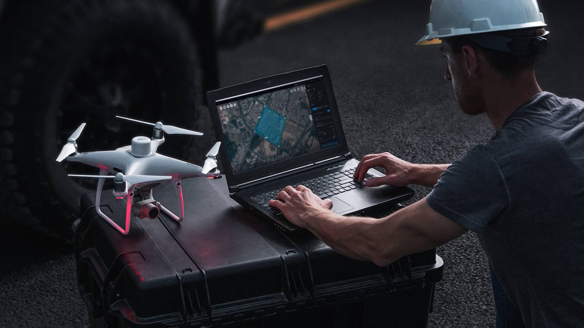
DJI GS Pro is a powerful, convenient and easy-to-use tool. With just a few taps on an iPad, complex flight routes can be created, giving critical missions greater precision and reliability. DJI GS Pro is an indispensable tool that is capable of greatly increasing efficiency and precision in a wide range of industries. Import KML / SHP files, adjust waypoints and create automatic flight missions.
Workflow
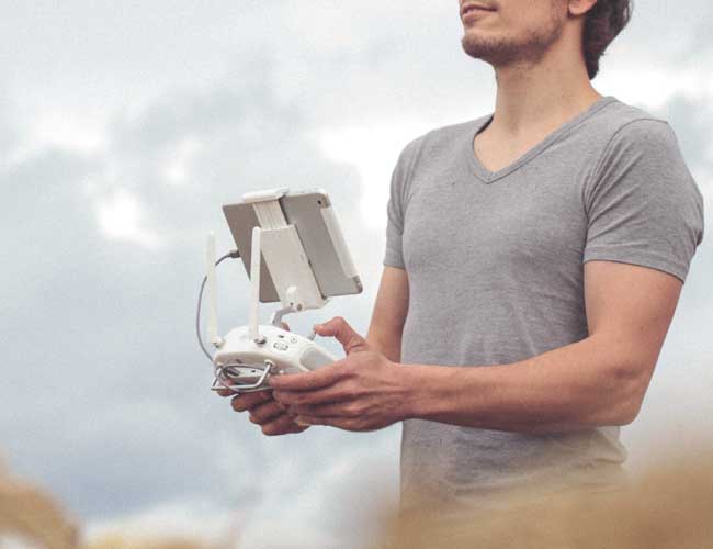
Plan your flights, carry out automatic missions, and manage fligt data with the DJI GS PRO App for iOS.
Process the aerial data applying specific metrics and parameters to obtain information about the general health of crops: NDVI MAPS
Targeted and specific treatments for designated areas on the basis of the data acquired are possible. You can target the objective needs with diverse interventions on different areas according to the prescription.
Gather multispectral data on large areas efficiently with the DJI Phantom 4 multipsectral and get a detailed overview of the isues.
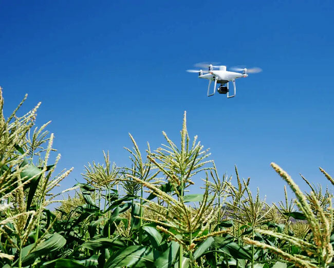
Monitor crops and identify issues in real time
DJI has created the P4 Multispectral platform with enhanced performance standards: only 27 minutes of flight with 7 km of transmission range.
Get instant information on crop health
The collection of images in agriculture is even simpler and more efficient. The multispectral Phantom with 5 multispectral sensors and the RGB camera on a stabilized gimbal provides accurate data on the health of the crops.

View both: RGB and multispectral data
RGB and multispectral data allow you to have in real time the preliminary analysis of the difference in vegetation index (NDVI) so that you can quickly make decisions on the targeted treatment to do and where to carry it out.

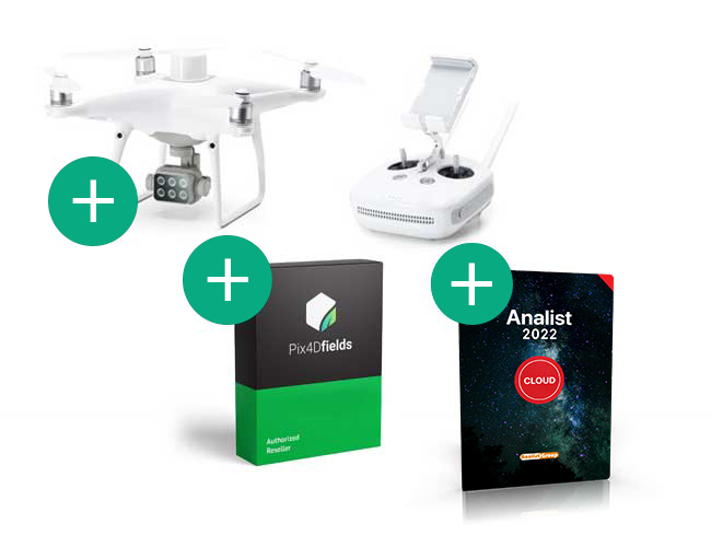
The DJI Phantom Multispectral Solution with Analist CLOUD AGRO includes:
• 1 DJI P4 Multispectral drone
• DJI GS Pro (Team-Professional) 1 year for the flight plan
• Enterprise Shield Basic 1 year (P4 Multispectral)
• Pix4Dfields 1 year for the generation of the vegetative vigor index map
• Analist CLOUD AGRO Subscription 1 year for zonation and map loading on smart devices and numerical control machines
• Online support and training.

Training included
Immediately operational.
Only we offer you a higher level training service: get in direct contact with our experts, who will guide you step-by-step in all operations, from flight plan settings to the final processings. Our team is at your disposal with all the knowledge and skills, do not miss the opportunity to immediately become an Expert.
Support included
Never alone.
Our Support service includes constant support on the basic and advanced use of the drone, on the use of the software and Apps. Our support tam is always available to help! Who can offer you more?
|
|
Drone |
Takeoff weight: 1487 g
|
Diagonal distance (without propellers): 350 mm |
Maximum altitude of tangency above sea level: 6000 m (19,685 ft) |
Maximum ascent speed: 6 m / s (automatic flight); 5 m / s (manual control) |
Maximum descent speed: 3 m / s |
Maximum speed: 50 km / h (P mode); 58 km / h (mode A) |
Flight time: about 27 minutes |
Operating temperature: 0 - 40 ° C |
Operating frequency: 2.4000 GHz - 2.4835 GHz (Europe, Japan, Korea) 5.725 GHz - 5.850 GHz (other countries / locations) |
Transmission power (EIRP) - 2.4 GHz: <20 dBm (CE / MIC / KCC) 5.8 GHz: <26 dBm (FCC / SRRC / NCC) |
Stationary flight accuracy
|
Compensation of the image position | The positions relative to the center of each CMOS sensor on the six cameras, and to the phase center of the integrated D-RTK antenna, are calibrated and reported on the EXIF data of each image. |
GNSS |
High sensitivity and single frequency GNSS module GPS + BeiDou + Galileo [2] (Asia); GPS + GLONASS + Galileo [2] (other regions) |
High precision multi-system and multi-frequency GNSS RTK: 282 x 373 x 84 mm (11.10 x 14.69 x 3.30 "):
|
Mapping Functions |
Ground sampling distance (GSD): (H / 18.9) cm / pixel, H indicates the altitude of the aircraft with respect to the mapped area (unit: m) |
Data acquisition frequency: Maximum operating area of about 0.63 km2 for a single flight at an altitude of 180 meters. Example: GSD is approximately 9.52 cm / pixel, with a front overlap rate of 80% and a lateral overlap rate of 60%, during a flight that consumes 70% of the total battery charge. |
Cardanic suspension (stabilization mechanism)
|
Controllable range: Inclination: from -90 ° to + 30 ° |
Visual system |
Speed range: ≤ 50 km / h at 2 m (6.6 feet) above the ground, with adequate lighting |
Altitude range: 0 - 10 m (0 - 33 ft) |
Operating range: 0 - 10 m (0 - 33 ft) |
Obstacle detection distance: 0.7 - 30 m (2 - 98 ft) |
Operating environment: defined texture surfaces, with adequate lighting (> 15 lux) |
Fotocamera |
Sensors: Six 1 / 2.9 "CMOS sensors, including an RGB sensor for visible light images and five monochromatic sensors for the acquisition of multispectral images. Each sensor: Effective pixels 2.08 MP (2.12 MP in total) |
Filters: Blue (B): 450 nm ± 16 nm, green (G): 560 nm ± 16 nm, red (R): 650 nm ± 16 nm, Red-Edge (RE): 730 nm ± 16 nm, near infrared (NIR): 840 nm ± 26 nm |
Lenses: FOV (field of view): 62.7 ° Focal length: 5.74 mm (35 mm equivalent format: 40 mm), autofocus at ∞ | Aperture: f / 2.2 |
RGB sensor ISO range: 200 - 800 |
Monochrome sensor gain: 1 - 8x |
Global electronic shutter: 1/100 - 1/20000 s (visible light); 1/100 - 1/10000 s (multispectral) |
Maximum image size: 1600 × 1300 (4: 3.25) |
Photo format: JPEG (visible light images) + TIFF (multispectral images) |
Supported file systems: FAT32 (≤ 32 GB); exFAT (> 32 GB) |
Supported SD cards: microSD with a minimum write speed of 15 MB / s. Capacity: 128 GB. Class 10 or UHS-1 standard |
Operating temperature: 0 - 40 ° C |
Smart battery (PH4-5870mAh-15,2V) |
Capacity: 5870 mAh |
Voltage: 15.2 V |
Battery type: LiPo 4S |
Energy: 89.2 Wh |
Net weight: 468 g |
Operating temperature: -10 - 40 ° C |
Charging temperature: 5 - 40 ° C |
Charging power: (max.) 160 W |
Smart flight battery charging station (CHARGING STATION FOR PHANTOM 4) |
Voltage: 17,5 V |
Operating temperature: 5 - 40 ° C |
Power adapter CA (PH4C160)
|
Voltage: 17.4 V |
|
Nominal power: 160 W |
DJI P4 Multispectral with Analist AGRO